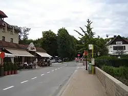
Mont-de-l'Enclus
| |
|---|---|
 | |
 Coat of arms | |
Location of Mont-de-l'Enclus | |
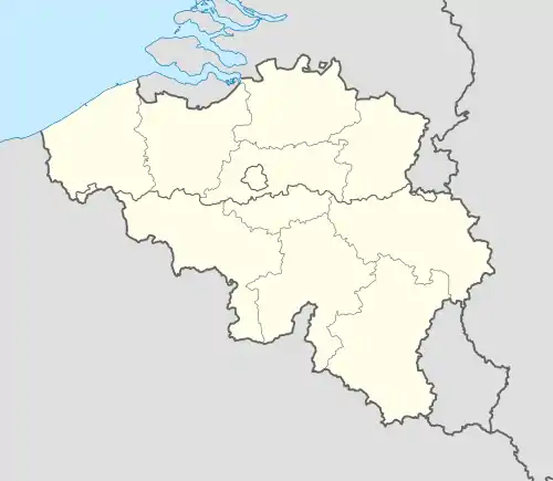 Mont-de-l'Enclus Location in Belgium
The municipality in the province of Hainaut  | |
| Coordinates: 50°44′N 3°30′E / 50.733°N 3.500°E | |
| Country | |
| Community | French Community |
| Region | Wallonia |
| Province | Hainaut |
| Arrondissement | Tournai-Mouscron |
| Government | |
| • Mayor | Jean-Pierre Bourdeaud'Huy (MR) |
| • Governing party/ies | MR |
| Area | |
| • Total | 27.16 km2 (10.49 sq mi) |
| Population (2018-01-01)[1] | |
| • Total | 3,720 |
| • Density | 140/km2 (350/sq mi) |
| Postal codes | 7750 |
| NIS code | 57095 |
| Area codes | 069 |
| Website | montdelenclus.be |
Mont-de-l'Enclus (French pronunciation: [mɔ̃ də lɑ̃kly] ⓘ; Dutch: Kluisberg [ˈklœyzˌbɛr(ə)x]; Picard: Mont-éd-l'-Enclus) is a municipality of Wallonia located in the province of Hainaut, Belgium.
It consists of the districts of Amougies, Anserœul, Orroir and Russegnies.
The municipality is located in Picardy Wallonia.
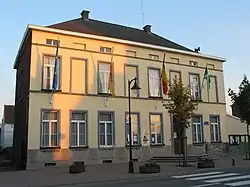
Mont-de-l'Enclus town hall
References
- ↑ "Wettelijke Bevolking per gemeente op 1 januari 2018". Statbel. Retrieved 9 March 2019.
External links
 Media related to Mont-de-l'Enclus at Wikimedia Commons
Places adjacent to Mont-de-l'Enclus | ||||||||||||||||
|---|---|---|---|---|---|---|---|---|---|---|---|---|---|---|---|---|
| ||||||||||||||||
| Ath | 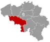 | |
|---|---|---|
| Charleroi | ||
| La Louvière | ||
| Mons | ||
| Soignies | ||
| Thuin | ||
| Tournai-Mouscron | ||
| ||
This article is issued from Wikipedia. The text is licensed under Creative Commons - Attribution - Sharealike. Additional terms may apply for the media files.