40°02′19″N 121°36′58″W / 40.03861°N 121.61611°W
Lomo | |
|---|---|
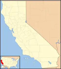 Lomo Location in California  Lomo Lomo (the United States) | |
| Coordinates: 40°02′19″N 121°36′58″W / 40.03861°N 121.61611°W | |
| Country | United States |
| State | California |
| County | Butte County |
| Elevation | 3,779 ft (1,152 m) |
Lomo (Spanish for "Hill") is an unincorporated community in Butte County, California. It lies 4.5 miles (7.2 km) of Butte Meadows,[2] at an elevation of 3779 feet (1152 m).
History
A post office operated at Lomo from 1878 to 1881.[2] It was previously known Wakefields Station.[2]
Lomo once had a lumber mill,[3] a school, and a hotel for travelers on the Humboldt Wagon Road.[4] The hotel burned down in 1882 and again in 1885.[5] Today, Lomo is little more than an intersection, with "a few occupied dwellings" in the surrounding forest.[6]
References
- ↑ U.S. Geological Survey Geographic Names Information System: Lomo, Butte County, California
- 1 2 3 Durham, David L. (1998). California's Geographic Names: A Gazetteer of Historic and Modern Names of the State. Clovis, Calif.: Word Dancer Press. p. 269. ISBN 1-884995-14-4.
- ↑ Chang, Anita L. (1992). The Historical Geography of the Humboldt Wagon Road. Chico, CA: Association for Northern California Records and Research. p. 23.
- ↑ Mark, Andy (2020). Stories of the Humboldt Wagon Road. Charleston, SC: The History Press. pp. 59–60. ISBN 978-1-4396-6978-5.
- ↑ Mark 2020, p. 87.
- ↑ Mark 2020, p. 146.
Municipalities and communities of Butte County, California, United States | ||
|---|---|---|
| Cities and towns | 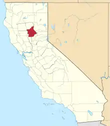 Butte County map | |
| CDPs | ||
| Unincorporated communities | ||
| Ghost towns |
| |
| Footnotes | ‡This populated place also has portions in an adjacent county or counties | |
This article is issued from Wikipedia. The text is licensed under Creative Commons - Attribution - Sharealike. Additional terms may apply for the media files.