Badlapur | |
|---|---|
 Badlapur | |
| Coordinates: 19°09′00″N 73°15′43″E / 19.15°N 73.262°E | |
| Country | |
| State | Maharashtra |
| District | Thane |
| Government | |
| • Type | Municipal Council |
| • Body | Kulgaon Badlapur Municipal Council |
| Area | |
| • Total | 35.68 km2 (13.78 sq mi) |
| Population (2011) | |
| • Total | 174,226 |
| Demonym | Badlapurkar |
| Languages | |
| • Official | Marathi |
| Time zone | UTC+5:30 (IST) |
| PIN | 421 503 |
| Telephone code | 0251 |
| Vehicle registration | MH-05 |
| Distance from Mumbai | 67 kilometres (42 mi) (rail) |
| Distance from Navi Mumbai | 44 kilometres (27 mi) (road) |
| Distance from Pune | 125 kilometres (78 mi) (rail) |
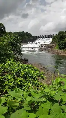
Badlapur (Pronunciation: [bəd̪lapuːɾ]) is a city in Thane district, Maharashtra state, India. Badlapur is a city on the banks of Ulhas River in Thane district of Maharashtra state in Konkan division. It is governed by Kulgaon-Badlapur Municipal Council.Badlapur is a city located just 40 km from Thane City in Thane district, Maharashtra, India. This city is a part of Mumbai Metropolitan Region managed by Municipal Council. The current estimated population of Badlapur city in 2023 is 238,000. It has a Badlapur railway station on the Central line of the Mumbai Suburban Railway
Demographics
Matheran Range
The Matheran Range starts at Haji Malang in the north-north-west, continues to Tavli in the north, and then runs south and finally terminates at Bhivpuri Road Hill. Strictly speaking, this range is not a part of the Sahyadris, but rather runs parallel to the Badlapur-Karjat railway line to its west. The Sahyadris proper run parallel to the same railway line, but to its east.[2]
References
- ↑ "Badlapur Population 2011". Census 2011.
- ↑ Kapadia, Harish (2004). Trek the Sahyadis. pp. 51–56. ISBN 978-8-173-87151-1. Retrieved 27 October 2015.