Hörselberg | |
|---|---|
 Coat of arms | |
Location of Hörselberg | |
 Hörselberg 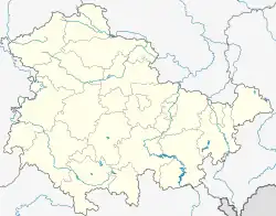 Hörselberg | |
| Coordinates: 50°58′50″N 10°25′45″E / 50.98056°N 10.42917°E | |
| Country | Germany |
| State | Thuringia |
| District | Wartburgkreis |
| Town | Hörselberg-Hainich |
| Disbanded | 1 December 2007 |
| Area | |
| • Total | 63.24 km2 (24.42 sq mi) |
| Highest elevation | 352 m (1,155 ft) |
| Lowest elevation | 260 m (850 ft) |
| Population (2006-12-31) | |
| • Total | 3,270 |
| • Density | 52/km2 (130/sq mi) |
| Time zone | UTC+01:00 (CET) |
| • Summer (DST) | UTC+02:00 (CEST) |
| Postal codes | 99819, 99848 |
| Dialling codes | 036920, 03622 |
| Website | www.gemeinde-hoerselberg.de |
Hörselberg is a former municipality in the Wartburgkreis district of Thuringia, Germany. Since 1 December 2007, it is part of the municipality Hörselberg-Hainich.
This article is issued from Wikipedia. The text is licensed under Creative Commons - Attribution - Sharealike. Additional terms may apply for the media files.