_sign.svg.png.webp) | ||||
|---|---|---|---|---|
| Davao–Bukidnon Road BuDa Road | ||||
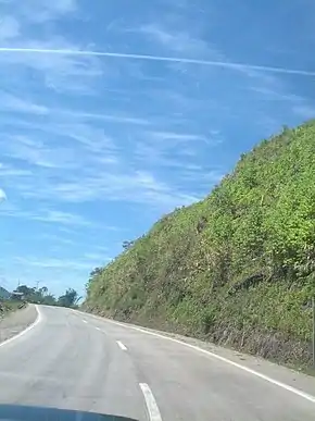 Bukidnon–Davao Road northbound, 2013 | ||||
| Route information | ||||
| Auxiliary route of AH 26 (26) | ||||
| Maintained by Department of Public Works and Highways | ||||
| Length | 140 km (87 mi) | |||
| Major junctions | ||||
| From | ||||
| To | ||||
| Location | ||||
| Country | Philippines | |||
| Provinces | Davao del Sur, Cotabato, Bukidnon | |||
| Major cities | Davao City | |||
| Towns | Arakan, Kitaotao, Quezon, Maramag | |||
| Highway system | ||||
| ||||
| ||||
The Bukidnon–Davao Road, often called as BuDa Road (a syllabic abbreviation of Bukidnon and Davao) and also known as Bukidnon–Davao City Road, is a 140-kilometer (87 mi), two-to-four lane national primary highway that connects Davao City[1] and the municipality of Maramag in Bukidnon.[2]
The entire road forms part of National Route 10 (N10) of the Philippine highway network and a spur of Asian Highway 26 (AH26) of the Asian highway network.
References
- ↑ "Davao City 2nd". www.dpwh.gov.ph. Retrieved 2018-08-27.
- ↑ "Bukidnon 2nd". www.dpwh.gov.ph. Retrieved 2018-08-27.
| Expressways |
| ||||||
|---|---|---|---|---|---|---|---|
| National highways |
| ||||||
This article is issued from Wikipedia. The text is licensed under Creative Commons - Attribution - Sharealike. Additional terms may apply for the media files.