South Aceh Regency
Kabupaten Aceh Selatan | |
|---|---|
.jpg.webp) Sikulat | |
 Seal | |
| Motto(s): Satya Bakti (Loyal and Devout) | |
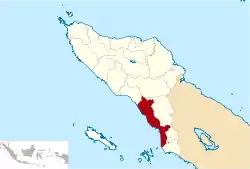 Location within Aceh | |
| Coordinates: 3°08′N 97°27′E / 3.133°N 97.450°E | |
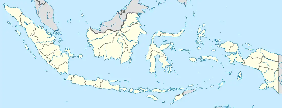
| Country | |
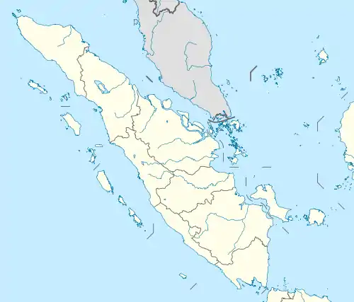
| Region | Sumatra |
| Province | |
| Established | 1956 |
| Regency seat | Tapaktuan |
| Government | |
| • Regent | Amran |
| • Vice Regent | Nasjuddin |
| Area | |
| • Total | 4,173.82 km2 (1,611.52 sq mi) |
| Population (mid 2022 estimate)[1] | |
| • Total | 237,376 |
| • Density | 56.9/km2 (147/sq mi) |
| Time zone | UTC+7 (IWST) |
| Area code | (+62) 656 |
| Website | acehselatankab.go.id |
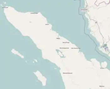
South Aceh Regency (Indonesian: Kabupaten Aceh Selatan) is a regency in the Aceh province of Indonesia. It is located on the west coast of the island of Sumatra. The regency covers an area of 4,173.82 square kilometres and had a population of 202,251 at the 2010 Census,[2] 224,588 at the 2015 Census and 232,414 at the 2020 Census;[3] the official estimate as at mid 2022 was 237,376.[1] Its population density at the 2010 census is 48.5 inhabitants/km2, while the population density at the 2015 census is 53.8 inhabitants/km2, 55.7 inhabitants/km2 at the 2020 census and the population density in mid 2022 is 56.9 inhabitants/km2. The seat of the regency government is at Tapaktuan. Some of the people of the regency are Minangkabau-descended Aneuk Jamee.[4]
Administrative districts
At the time of the 2010 Census, the regency was divided administratively into sixteen districts (kecamatan). Subsequent to 2010, two additional districts (Trumon Tengah and Kota Bahagia) were created by being carved out of existing districts. The districts are listed below with their areas and populations at the 2010 Census[2] and the 2020 Census,[3] together with the official estimates for mid 2022.[1] The table also includes the locations of the district administrative centres, the number of villages (gampong) in each district, and its postal codes.
| Kode Wilayah | Name of District (kecamatan) | Area in km2 | Pop'n Census 2010 | Pop'n Census 2020 | Pop'n Estimate mid 2022 | Admin centre | No. of villages | Post codes |
|---|---|---|---|---|---|---|---|---|
| 11.01.09 | Trumon (a) | 765.92 | 5,614 | 6,025 | 6,399 | Keude Trumon | 12 | 23774 |
| 11.01.16 | Trumon Timur (East Trumon) | 285.34 | 10,340 | 8,528 | 8,902 | Krueng Luas | 8 | 23776 |
| 11.01.18 | Trumon Tengah (Central Trumon) | 123.50 | (b) | 6,692 | 6,988 | Ladang Rimba | 10 | 23775 |
| Subtotal Trumon area (c) | 1,174.76 | 15,954 | 21,245 | 22,289 | 30 | |||
| 11.01.01 | Bakongan (a) | 57.62 | 10,913 | 5,364 | 5,450 | Bakongan | 7 | 23773 |
| 11.01.15 | Bakongan Timur (East Bakongan) | 73.81 | 5,208 | 6,177 | 6,336 | Seubadeh | 7 | 23777 |
| 11.01.17 | Kota Bahagia (Bahagia Town) | 244.63 | (d) | 7,006 | 7,127 | Bukit Gadeng | 10 | 23778 |
| 11.01.03 | Kluet Selatan (South Kluet) | 106.58 | 12,477 | 14,380 | 14,672 | Kandang | 17 | 23772 |
| 11.01.14 | Kluet Timur (East Kluet) | 449.03 | 9,418 | 10,541 | 10,888 | Paya Dapur | 9 | 23779 |
| 11.01.02 | Kluet Utara (North Kluet) | 73.24 | 22,271 | 24,864 | 25,231 | Kota Fajar | 21 | 23771 |
| 11.01.10 | Pasie Raja | 98.11 | 15,500 | 18,038 | 18,433 | Ladang Tuha | 21 | 23755 |
| 11.01.13 | Kluet Tengah (Central Kluet) | 801.08 | 6,120 | 7,503 | 7,745 | Manggamat | 13 | 23770 |
| 11.01.08 | Tapaktuan | 100.73 | 22,540 | 23,190 | 23,465 | Tapaktuan | 18 | 23711 - 23718 |
| 11.01.06 | Samadua | 112.91 | 14,440 | 16,055 | 16,263 | Samadua | 28 | 23752 |
| 11.01.07 | Sawang (a) | 189.38 | 13,679 | 15,968 | 16,328 | Sawang | 15 | 23753 |
| 11.01.05 | Meukek | 465.06 | 18,261 | 20,956 | 21,358 | Meukek | 23 | 23754 |
| 11.01.04 | Labuanhaji | 54.83 | 11,823 | 13,389 | 13,611 | Labuhanhaji | 16 | 23761 |
| 11.01.11 | Labuanhaji Timur (East Labuanhaji) | 95.50 | 9,137 | 10,032 | 10,137 | Peulumat | 12 | 23758 |
| 11.01.12 | Labuanhaji Barat (West Labuanhaji) | 76.56 | 15,495 | 17,706 | 18,043 | Blang Keujeren | 15 | 23757 |
| Totals for regency | 4,173.82 | 202,251 | 232,414 | 237,376 | Tapaktuan | 260 |
Note: (a) including small offshore islands. (b) The 2010 population of Trumon Tengah District is included in the 2010 figure for Trumon Timur District, from which it was split. (c) The Trumon area which forms the southern 28% of the Regency is adjacent to the city of Subulussalam to the east. (d) The 2010 population of Kota Bahagia District is included in the 2010 figure for Bakongan District, from which it was split.
See also
References
- 1 2 3 Badan Pusat Statistik, Jakarta, 2023, Kabupaten Aceh Selatan Dalam Angka 2023 (Katalog-BPS 1102001.1101)
- 1 2 Biro Pusat Statistik, Jakarta, 2011.
- 1 2 Badan Pusat Statistik, Jakarta, 2021.
- ↑ Davies, Matthew N. (2006). Indonesia's war over Aceh: last stand on Mecca's porch. Taylor & Francis. pp. 21–. ISBN 978-0-415-37239-8. Archived from the original on 15 September 2023. Retrieved 20 December 2010.
External links
- South Aceh Regency (in Indonesian)
Regencies and cities of Aceh | ||
|---|---|---|
Capital: Banda Aceh | ||
| Regencies |  | |
| Cities | ||
3°08′N 97°27′E / 3.133°N 97.450°E